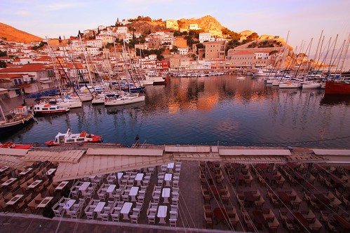
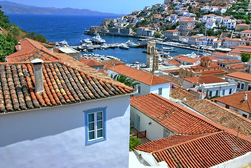
Hydra (Greek: Ύδρα, pronounced [ˈiðra], Arvanitika: Nιδρα, Nidhra) is one of the Saronic Islands of Greece, located in the Aegean Sea between the Saronic Gulf and the Argolic Gulf. It is separated from the Peloponnese by the narrow Hydra Gulf. Hydra is also a municipality and one of the few provinces in Greece to have two municipalities—which includes the island of Dokos (pop. 13)—yet fewer than five communes. In ancient times, the island was known as Hydrea (Υδρέα, derived from the Greek word for "water"), which was a reference to the springs on the island.
Hydra depends upon tourism and Athenians comprise a sizable segment of its visitors. High speed hydrofoils and catamarans from Piraeus serve Hydra, as do daily island tour boats. Garbage trucks are the only motor vehicles on the island; horses, donkeys and water taxis provide public transportation. The inhabited area, however, is so compact that most people walk everywhere.
There is one main town, known simply as "Hydra port" (pop. 2,526 in 2001). It consists of a crescent-shaped harbor, around which is centered a strand of restaurants, shops, markets, and galleries that cater to tourists and locals (Hydriots).
Steep stone streets lead up and outwards from the harbor area. Most of the local residences, as well as the hostelries on the island are located on these streets. Other small villages or hamlets on the island include Mandraki (pop. 33), Kamini, Vlychos (28), Palomitha (18), Episkopi (23), and Molos (2). As of the mid-20th century, the majority of the island's population were Arvanites.
Although the island's name is derived from ancient springs, it is now almost dry. Hydra previously had wells and three new wells have been found. Today, the island imports its water by boat from the Greek mainland but a new desalinization plant is now in operation.
The dominant geographic features of Hydra are its rocky hillsides, which are bare, pine forested valleys with the occasional farmhouse and six Orthodox monasteries. Two particularly noteworthy ones are Profitis Ilias, founded in the 19th Century, and Ayia Efpraxia. Both are on a hill overlooking the harbor.
Hydra doesn't have much in the way of sandy beaches, but there are plenty of smooth rocks and pebbly bays for sunbathers. The water is clear and local daredevils show off by diving off the cliff on the road to Kamini — don't try this unless you know what you're doing!
The only good swimming spot within easy access of town is the rocky shore called Spilia in the Kamini district on the west edge of town; just walk along the main coastal road leading west for about twenty minutes, and it's just past the large cafe-bar.
This area isn't really a "beach" but a rocky area which has been slightly developed by the addition of a few stairs and level places in the rocks which are good for sunbathing. To swim, you need to climb in and out of the water via some rather primitive ladders set in the sea wall (and beware of sea urchins on wall,) which might be difficult for some people. The water, however, is clean, and usually calm except when a boat sails by close to shore. The view is beautiful.


0 comments:
Post a Comment